unmanned aerial systems (UAS), are aircraft without a human pilot on board that are designed for monitoring, observing, and collecting data from the air. These drones are equipped with various sensors, cameras, and communication systems to perform surveillance and reconnaissance tasks.


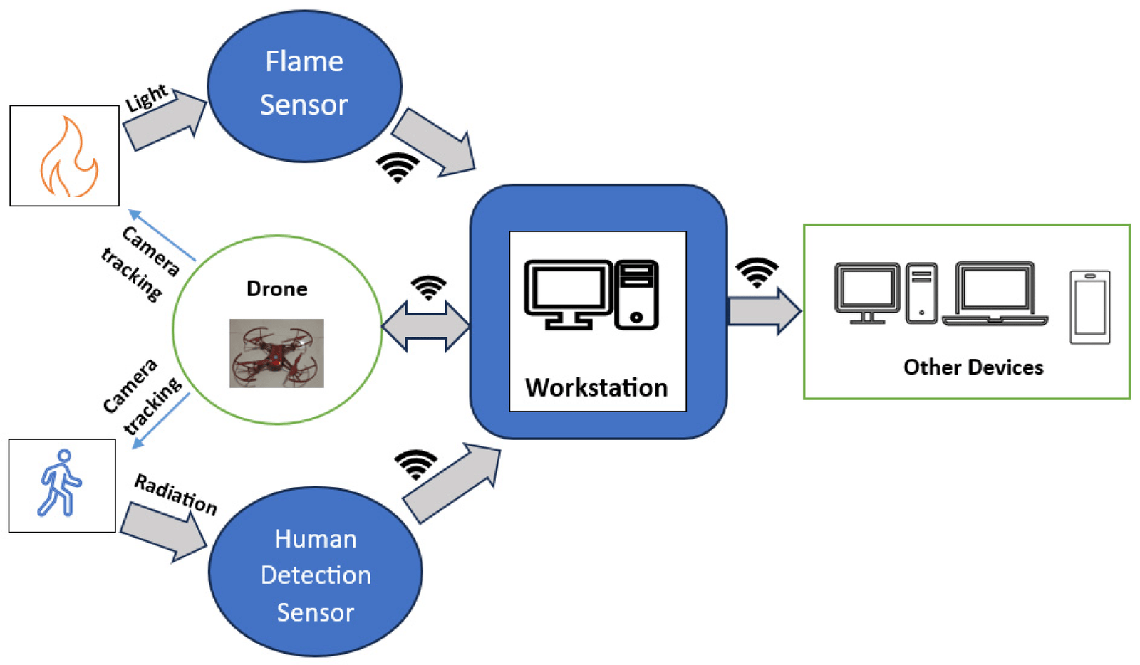
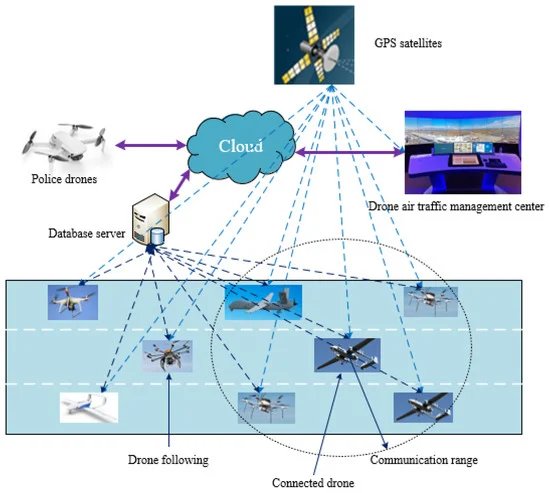
Many surveillance drones have autonomous flight capabilities, allowing them to follow predefined flight paths or waypoints. This autonomy reduces the need for constant manual control and enables the drone to carry out surveillance tasks efficiently.
Surveillance drones are often equipped with systems for real-time video transmission. This allows operators on the ground to monitor live feeds and respond rapidly to unfolding events.
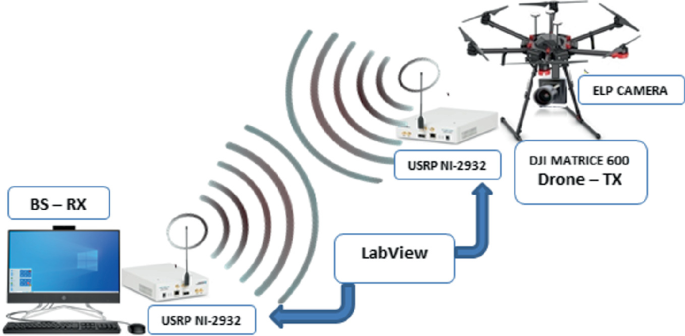
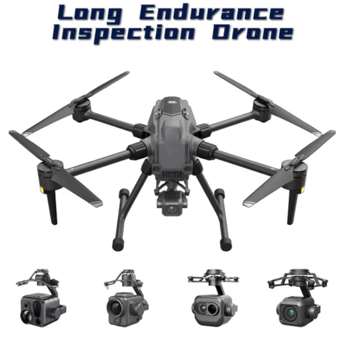
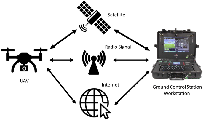
Surveillance drones typically feature communication systems that allow them to transmit data, including live video feeds and telemetry, to a ground control station or command center. This facilitates real-time decision-making.
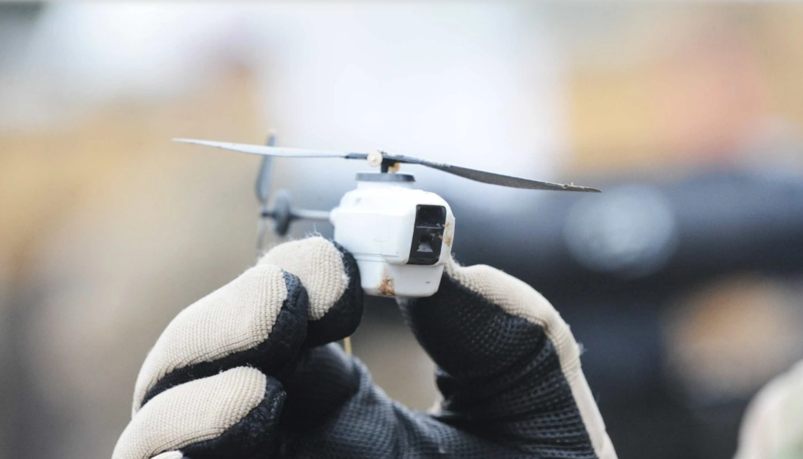
Many surveillance drones are compact and portable, making them easy to transport and deploy quickly. This feature is particularly beneficial in scenarios where rapid response and mobility are critical.
Surveillance drones often integrate with GIS software, allowing for the mapping and analysis of geospatial data. This integration enhances the effectiveness of surveillance by providing a spatial context to the collected information.

Surveillance drones can be employed for monitoring natural resources, wildlife, and environmental conditions. This includes tasks such as monitoring forests, tracking wildlife migration, and assessing environmental changes.
